Showing posts with label French Polynesia. Show all posts

Friday, May 19, 2017

French Polynesia - Huahine Island

Paysage de Huahine
Landscape of Huahine

- - - - - - -

Huahine is an island located among the Society Islands, in French Polynesia, an overseas territory of France in the Pacific Ocean. It is part of the Leeward Islands group.

The island has a population of about 6,300.

Wednesday, November 16, 2016

French Polynesia - Moorea with Cruise Ship

Moorea, French Polynesia

Photo by Brenda Perez
2015

- - - - - - -

Mo'orea is a high island in French Polynesia, one of the Windward Islands, part of the Society Islands. The true spelling of Mo'orea is Mo'ore'a, which means "yellow lizard" in Tahitian: Mo'o = lizard ; Re'a = Yellow. 

Wednesday, January 1, 2014

French Polynesia - Bora Bora, Water View

Tahiti et ses Iles. (Tahiti and its Islands)
Bora Bora

Le motu Topua, Bora Boara (Motu Toopua)
Photo: Teva Sylvain
2012

French Polynesia - Bora Bora, Map and Multiview

Bora Bora, perle du Pacifique.
Bora Bora, The South Pacific Pearl.
2012

Friday, June 29, 2012

French Polynesia - Bora Bora, Map of the Island


Bora Bora

Voyage vers le Sud (Travel to the South)
2012

- - - - - - -

Bora Bora is an island in the Leeward group of the Society Islands of French Polynesia, an overseas collectivity of France in the Pacific Ocean.

The island is surrounded by a lagoon and a barrier reef. In the center of the island are the remnants of an extinct volcano rising to two peaks, Mount Pahia and Mount Otemanu, the highest point at 727 meters (2,385 ft).

When we were here, we took a jet boat tour around the island and stopped in a few places to snorkel.  The water was crystal clear and the views were spectacular!

French Polynesia - Bora Bora, Mount Otemanu


Bora Bora

Le mont Otemanu
Otemanu Mount
2012

- - - - - - -

Mount Otemanu is an ancient volcano that rises up sharply more than 2,400 feet.

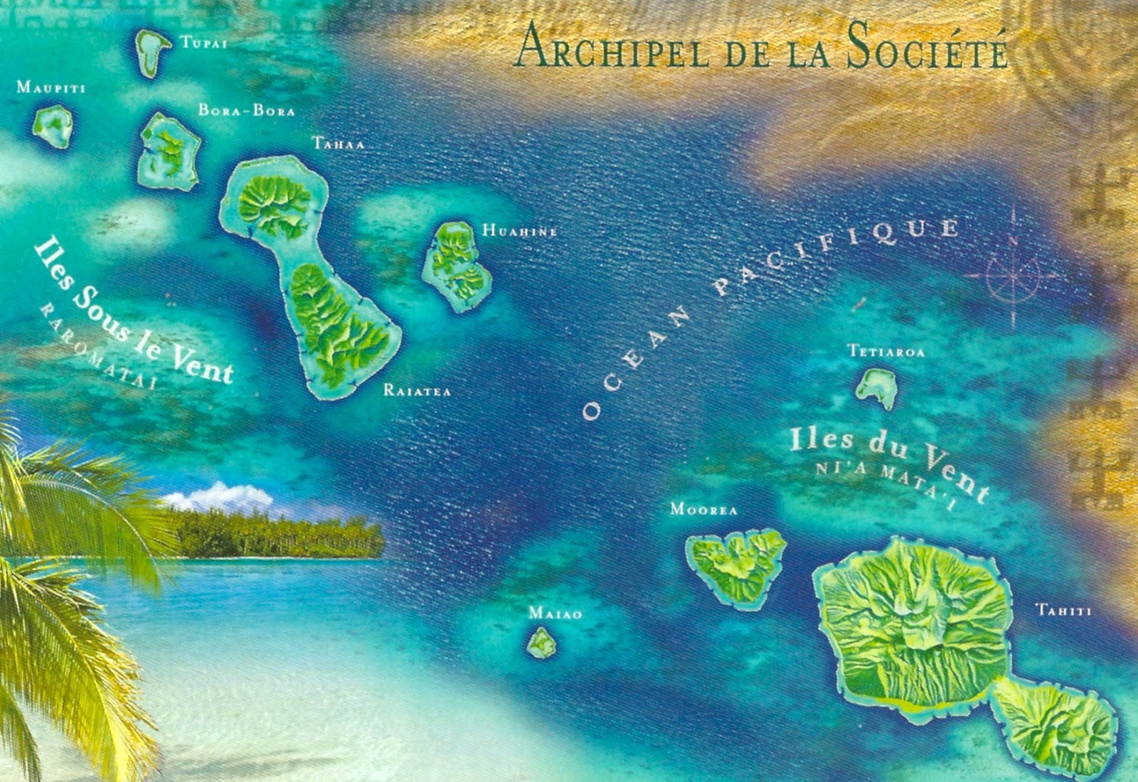
French Polynesia - Map of the Society Islands


Archipel de la Societe

Les iles de la Societe
Seules les iles principales ont ete representees.
Les distances entre les iles sont inexactes

translation:
Archipelago of the Society Islands

The Society Islands
Only the main islands were represented.
Distances between islands are inaccurate
2012

- - - - - - -

The Society Islands are a group of islands in the South Pacific Ocean. They are politically part of French Polynesia. The archipelago is suspected to have been named by Captain James Cook supposedly in honour of the Royal Society, the sponsor of the first British scientific survey of the islands; however, Cook himself stated in his journal that he called the islands Society "as they lay contiguous to one another".

The islands are divided, both geographically and administratively into two groups:

Windward Islands (Îles du Vent) (listed from east to west)
Mehetia
Tahiti
Tetiaroa
Moorea
Maiao

Leeward Islands (Îles Sous-le-Vent)
Huahine
Raiatea
Tahaa
Bora Bora
Tupai
Maupiti
Mopelia
Motu One (Bellinghausen)
Manuae

French Polynesia - Moorea - Mont (Mount) Rotui


Mont Rotui, Moorea

Le Mont Rotui (899m), enlace par les baies de Cook et D'Opunohu, Moorea.
Mount Rotui (2949'), ebraced by Cook's and Opunohu's Bays.
2012

French Polynesia - Moorea, Map of the Island


Moorea
Voyage vers le Sud (Travel to the South)
2012

French Polynesia - Pearl Farm in the Lagoon af Ahe, Tuamotu


Tuamotu
Islands of the South Pacific

Ferme perliere dans le lagon de Ahe - Tuamotu
A Pearl Farm in the Lagoon of Ahe - Tuamotu Islands
2012

- - - - - - -

The Tuamotus or the Tuamotu Archipelago are a chain of islands and atolls in French Polynesia. They form the largest chain of atolls in the world, spanning an area of the Pacific Ocean roughly the size of Western Europe.


Ahe, Ahemaru or Omaru, is an almost entirely-enclosed coral atoll, located in the northern Tuamotu Archipelago, just 14 km to the west of Manihi, in French Polynesia.

Ahe Atoll's ring shape is broken by only a single small passage into the lagoon.

Ahe Atoll has 441 inhabitants. The only village in Ahe is Tenukupara with approximately 100 inhabitants.

Geographically Ahe Atoll is part of the King George Islands (Iles du Roi Georges) subgroup, which includes Ahe, Manihi, Takapoto, Takaroa and Tikei.

There are several pearl farms in Ahe's lagoon.

French Polynesia - Tahiti - a Polynesian Canoe


Tahiti et ses Iles  (Tahiti and Her Islands)

Une pirogue polynesienne a la presqu ile de Tahiti (A Polynesian canoe to Tahiti's peninsula)
2012

French Polynesia - Tahiti and Her Islands Calendar of 2012


Tahiti et ses Iles  (Tahiti and Her Islands)
January - Tahiti
February - Tetiaroa
March - Moorea
April - Rangiroa
May - Rangiroa
June - Rangiroa
July - Tahiti
August - Maupiti
September - Rangiroa
October - Bora Bora
November - Tetiaroa
December - Rangiroa

Vues de Polynesie (View of Polynesia)
Calendrier 2012 (Calendar 2012)

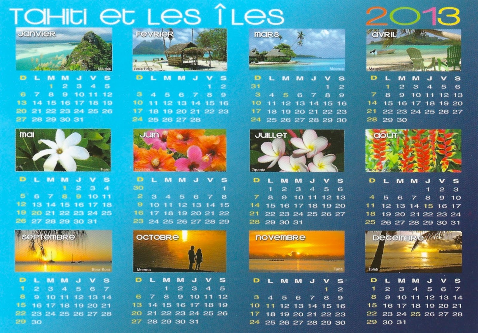
French Polynesia - Tahiti and Her Islands Calendar of 2013


Tahiti et les Iles (Tahiti and her islands)

Vues de Polynesie (View of Polynesia)
Calendrier 2013 (Calendar 2013)

unused

French Polynesia - Tahiti and her Islands (with Moorea)


Tahiti et ses Iles (Tahiti and her Islands)

Moorea
2012

French Polynesia - Tahiti Flag


Tahiti
Voyage vers le Sud (Travel to the South)

Vue de Polynesia - Drapeau de la Polynesie Francaise (View of Polynesia - Flag of French Polynesia)
2012

- - - - -

two red horizontal bands encase a wide white band in a 1:2:1 ratio; centered on the white band is a disk with a blue and white wave pattern depicting the sea on the lower half and a gold and white ray pattern depicting the sun on the upper half; a Polynesian canoe rides on the wave pattern; the canoe has a crew of five represented by five stars that symbolize the five island groups; red and white are traditional Polynesian colors

French Polynesia - Tahiti, Intercontinental Resort


Tahiti
Voyage vers le Sud (Travel to the South)

Vue Polynesie (View Polynesia) - InterContinental Resort Tahiti
2012

- - - - - - -

The hotel features private beach, two pools, tennis courts, and 30 acres of private gardens. Plus, Papeete’s museums, shops, galleries, market, and nightclubs are just a short distance away.

Facing the sister island of Moorea, 12 miles away, the hotel will offer you unique views of unforgettable sunsets. You can also have a unique experience in an overwater bungalow. (You can see the roofs of the bungalows in the postcard).

French Polynesia - Tahiti, Javelin During Heiva - July Festivities


Les iles du Pacifique Sud
Islands of the Pacific

Competitoin de javelot durant le Heiva
The javelin during Heiva - July Festivities
2012

- - - - - - -

In Tahitian, the word Heiva (hei meaning to assemble, and va meaning community places) refers to activities, pastimes, physical exercise, and festivals. Music, dancing, singing and sporting events have always held an important place in Polynesian communities. In ancient times, they were essential components of religious and political ceremonies.

French Polynesia - Tahiti, Map of the Island


Tahiti

Voyage vers le Sud (Travel to the South)
2012

French Polynesia - Tuamotu Islands - Beach of Ahe


Tuamotu
Islands of the South Pacific

Coucher de soleil sure un motu de l'atoll de Ahe - Tuamotu
Sunset on a beach of Ahe - Tuamotu Islands
2012

- - - - - - -

The Tuamotus or the Tuamotu Archipelago are a chain of islands and atolls in French Polynesia. They form the largest chain of atolls in the world, spanning an area of the Pacific Ocean roughly the size of Western Europe.


Ahe, Ahemaru or Omaru, is an almost entirely-enclosed coral atoll, located in the northern Tuamotu Archipelago, just 14 km to the west of Manihi, in French Polynesia.

Ahe Atoll's ring shape is broken by only a single small passage into the lagoon.

Ahe Atoll has 441 inhabitants. The only village in Ahe is Tenukupara with approximately 100 inhabitants.

Geographically Ahe Atoll is part of the King George Islands (Iles du Roi Georges) subgroup, which includes Ahe, Manihi, Takapoto, Takaroa and Tikei.

There are several pearl farms in Ahe's lagoon.